When you book a letterbox drop, you (rightly) expect that
it’ll be done properly. You want to get what you paid for and after all, how
hard can it be to put stuff in a letterbox.
In the case of community engagement clients, making sure the job is done properly and that there’s a record of where it was delivered is doubly important. In many cases there’s a statutory requirement to notify the community about a project, consultation or upcoming works.
You decide that you’ll employ a distribution company that GPS tracks it’s distributors. It’ll give you some surety that the job has been completed and you’ll have some map images to include in your reporting. GPS is great, but like any system it’s not fool proof and in some cases it can be used to give the impression that the job has been done well when it hasn’t.
Let me share with you some of the things to look for when you get sent your GPS report.
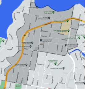
GOTTA START WITH A DEFINED MAP AREA
If you don’t start with a clear defined idea of where you’re distributing then you’re not going to be able to make sense of where the GPS tracks are in relation to your distribution area. Ideally the map should be housed online so the tracks can be super imposed on top of the map area to make sure the distributors walked to the boundary of the map area.
Clearly mapped boundary
What are the distributors using to track where they’re going?
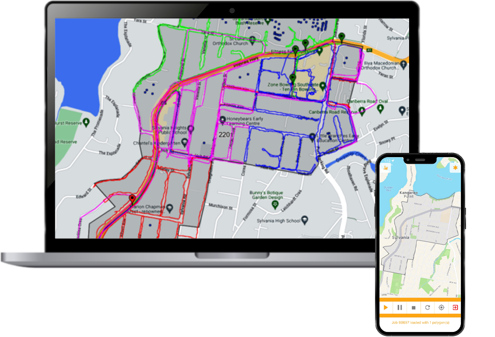
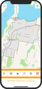
ManageMyPost phone app
Ideally the distributors will have a live map of the area they’re doing and will be able to see where they are tracking overlaid on the map in real time. At DanD we do this using our ManageMyPost phone app.
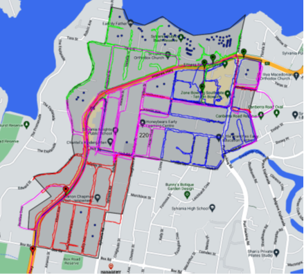
Check the tracks
On a job where you need 100% coverage it’s best to check the tracks while the distributors are still in the field so they can go back and patch up any areas they’ve missed.
At DanD we get the distributors to upload the tracks while they’re still in the field. Each one of the different coloured lines is a separate distributor and we check each track before they return to base.
When analysing the tracks, the team checks speed data (to make sure they’ve been walked and not driven). They also analyse the proximity of the track to letterboxes and the movement of the track into businesses and dense apartment buildings.
GPS Tracks Overlayed
There’s some smarts as to how this is done, but as a rule walking tracks should be around 4 to 5 km’s per hour in low density areas, slowing to 2km’s per hour in higher density areas and business districts.
Send me a live map!
If your distribution company is sending you screen shots of the map with GPS tracks, it’s impossible to zoom in on areas where one of your stakeholders is complaining they didn’t receive a notification.
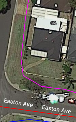
In the event that you’ve got an unhappy stakeholder you should be able to zoom down to the address, view the path of the GPS track in relation to the property…
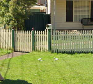
You can then check where the letterbox is on street view.
Did they get in everywhere?
Letterboxing is still the most reliable way to make sure everyone in your catchment gets a notification, however getting into every business and residential property can be more difficult in some areas than others.
Some areas have securelocked buildings (both residential and commercial) where the letterboxes can’t easily be accessed. These buildings may require multiple attempts to access, either by getting the building managers details or by waiting until someone is leaving the building.
If your distribution company is doing a job in an area with a lot of secure buildings (like the Sydney CBD) and they don’t inform you they couldn’t get in somewhere, it’s worth asking questions.
If you enjoyed this blog post, please take a look at some of the other ones featured on our website.
Got any distro questions or need a quote? Drop us a line!